
A new project is using Google’s street view technology
to map the world’s coral reefs.
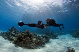
SVII in the Coral Sea. Image courtesy Catlin Seaview Survey
Transcript of the Audio Podcast:
Dive into the ocean from your computer…on this CurrentCast.
Working with Google’s Street View, experts developed a 360-degree camera system mounted on an underwater scooter to record images as never seen before.
In a five year project, the world’s coral reefs are being recorded to view the effects of climate change and other adverse pressures on these sensitive living organisms.
Richard Vevers, project director of the Catlin Seaview Survey and founder of Underwater Earth.
Vevers: “We need this data to be available so people can see what is happening and then act accordingly.”
Now virtually anyone can explore the coral reefs and whet their appetite for conservation.
Support for CurrentCast comes from the Mitsubishi Corporation Foundation for the Americas. Learn more online at http://www.current-cast.org.
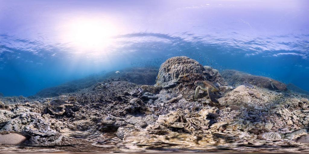
Green Turtles, Heron Island, Australia. Image courtesy of Catlin Seaview Survey.
Learn More – Videos:

Richard Vevers
Learn More – Web sites: