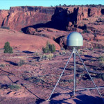
GPS stations can detect drought by measuring when the earth’s crust lifts or depresses. Transcript of the Audio Podcast: A surprising discovery from GPS technology…on this CurrentCast. In the western United States, a network of highly precise GPS stations measure the movement of tectonic plates – collecting data about possible earthquakes. Scientists have discovered, quite …
Tag Archive: GPS
Permanent link to this article: http://www.currentcast.org/uncategorized/using-gps-to-track-water-levels/


