
British rivers have their own Twitter accounts that
inform the public about high and low levels.
 Transcript of the Audio Podcast:
British rivers get their own Twitter accounts, and we’re following… on this CurrentCast.
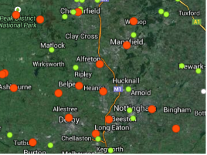
The UK has a network of gauges dispersed in rivers around the country – transmitting data about water levels and flooding. Now, the public can access this information via social media.
Plummer: “It’s not just about flooding. It’s about fishing. It’s about boating. It’s about pleasure.”
That’s Rod Plummer, Managing Director of Shoothill Limited, the software development company that created GaugeMap. This system links the data from river gauges to pins on a Google map. Users can sort the pins by water level or subscribe to a specific gauge on Twitter, so they automatically receive updates.
Plummer hopes to implement the technology in other countries. He says it’s feasible wherever there is a network of river level gauges.

Rod Plummer of Shoothill
Support for CurrentCast comes from the Mitsubishi Corporation Foundation for the Americas. Learn more online at CurrentCast.org.
Learn More:
- Gaugemap
- “New technology uses social media to keep track of water levels” from the Guardian
- “Shoothill provides EA’s live river level data via Twitter” from Digital by Default News
- “GaugeMap Brings Real-Time Environment Agency River Info to Life” – press release from Shoothill Limited